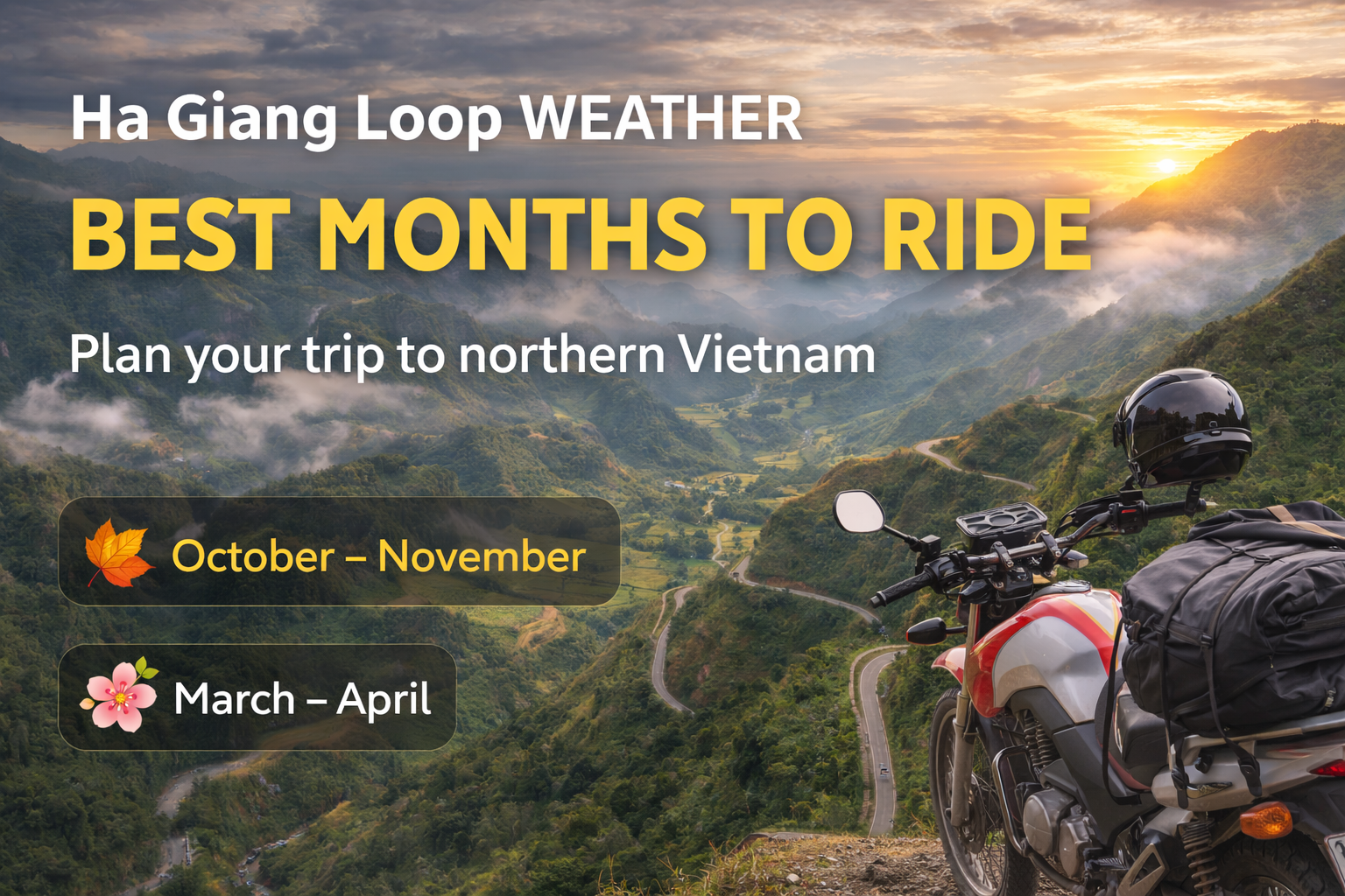
The Ha Giang Loop is one of Vietnam’s most stunning motorbike routes.
A thrilling journey through mountains, rice terraces, and remote ethnic villages. Located in the far north of Ha Giang Province, near the Chinese border, the loop can be completed in 2, 3, or 4 days depending on your time and pace.
Whether you ride solo, with an easy rider, or in a Jeep tour, this adventure promises endless landscapes, local smiles, and some of the most iconics roads in Southeast Asia.
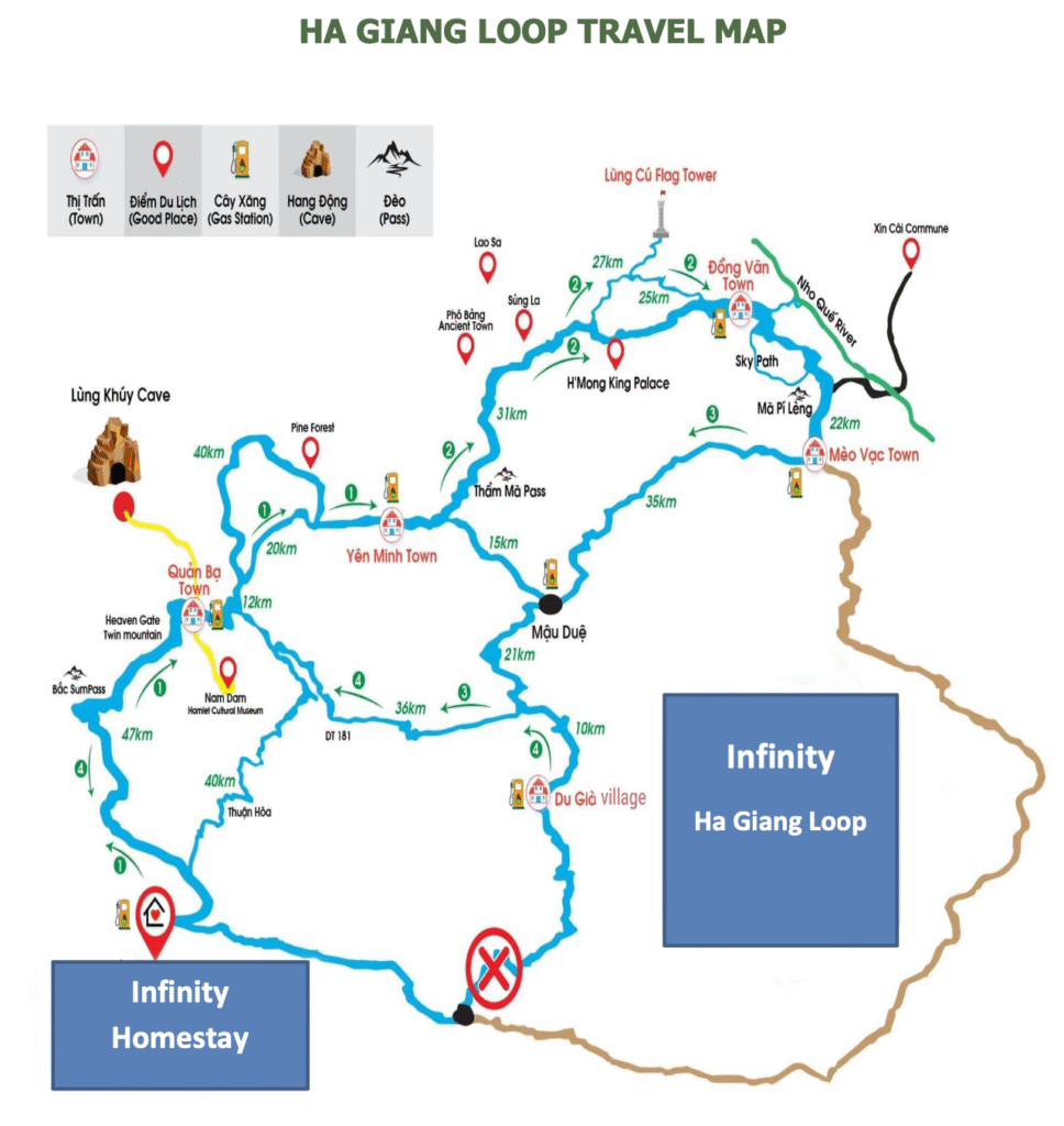
Ha Giang Loop Map - Itinerary on Google Maps
Where is the Ha Giang Loop?
The loop is located in Ha Giang Province, about 300 km north of Hanoi. It starts and ends in Ha Giang City, the capital of the province. From there, riders travel through Quan Ba, Yen Minh, Dong Van, and Meo Vac, often extending the route to Du Gia or Lung Cu, the northernmost point of Vietnam.
Each section of the loop offers a different view of Vietnam’s natural beauty — from high limestone peaks to quiet small villages and valleys where ethnic minorities have lived for centuries.
Why Do You Need a Ha Giang Loop Map?
A Ha Giang Loop map helps you plan your route, distances, and rest stops efficiently. It’s easy to get lost among the winding roads and mountain passes, and having a clear map saves you time and energy.
It also highlights key landmarks such as Ma Pi Leng Pass, Heaven Gate, or Lung Cu Flag Tower, so you don’t miss any of the must-see points along the way.
What Are the Must-See Places on the Ha Giang Loop Map?
1. Ma Pi Leng Pass
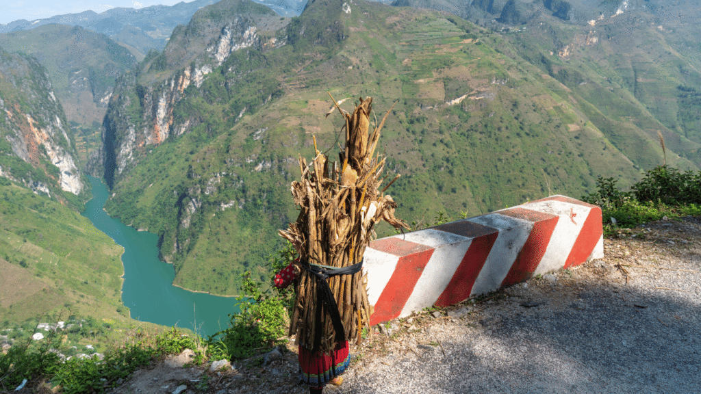
The Ma Pi Leng Pass is often called the most spectacular mountain road in Vietnam. Stretching between Dong Van and Meo Vac, it offers dramatic cliffs and sweeping views over the emerald Nho Que River. Riding along this pass feels like flying above the clouds (an absolute must for anyone doing the Ha Giang Loop).
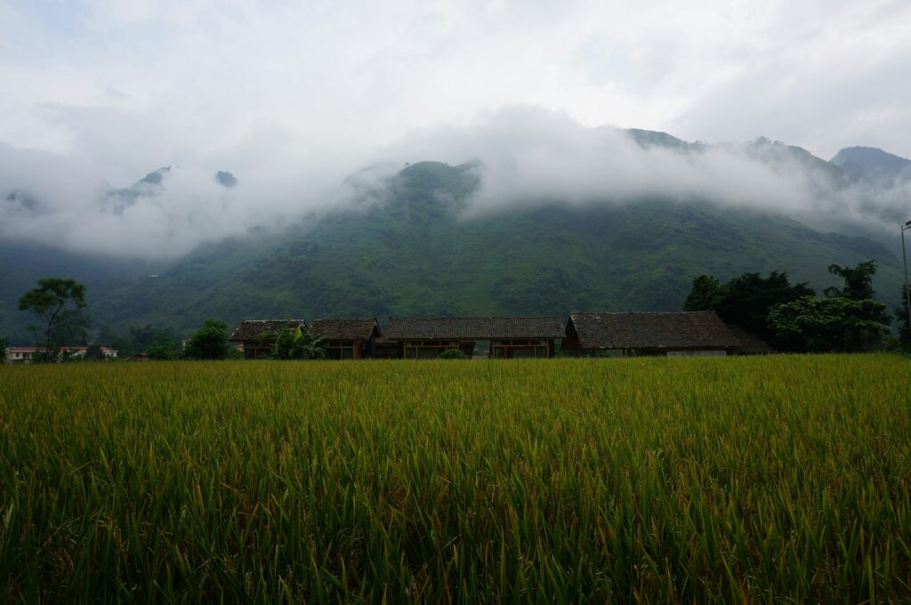
2. Du Gia Village
Nestled in a green valley, Du Gia is a peaceful Hmong village surrounded by rice terraces and waterfalls. Travelers love stopping here to swim in the Du Gia Waterfall or share a family-style dinner with locals. It’s the perfect place to slow down and experience authentic life in the Ha Giang mountains.
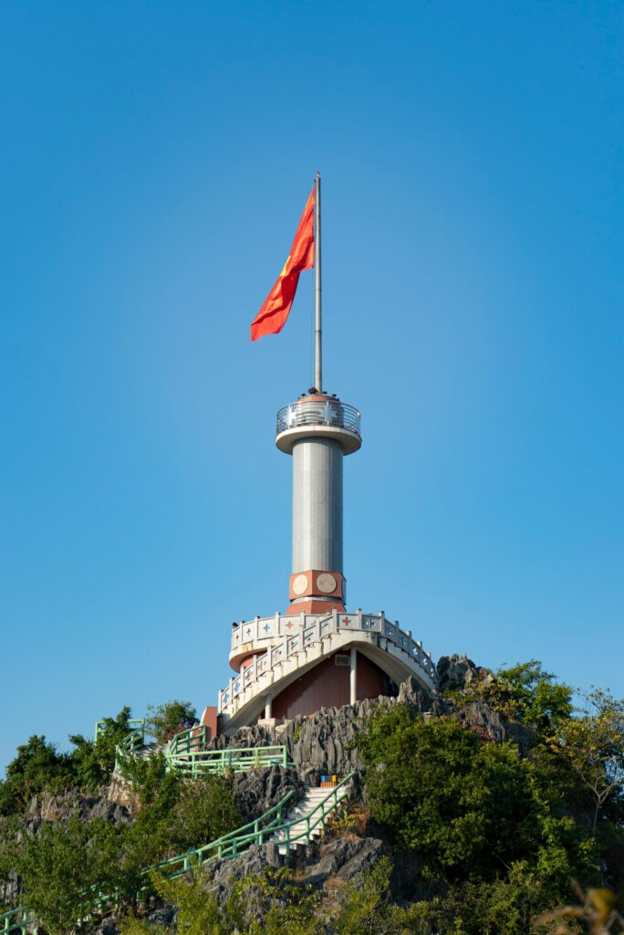
3. Lung Cu Flag Tower
The Lung Cu Flag Tower stands proudly at Vietnam’s northernmost point, just a few kilometers from the Chinese border. From the top, you can admire panoramic views of the surrounding karst peaks and villages. Visiting Lung Cu is both symbolic and breathtaking — a moment of pride for many Vietnamese travelers.
4. Heaven Gate (Quan Ba)
Located near Quan Ba Town, the Heaven Gate viewpoint opens to one of the most beautiful panoramas in Ha Giang. From here, you can see the famous Twin Mountains rising from the misty valley below. It’s a perfect first stop on the loop, giving you a taste of the dramatic scenery that awaits.
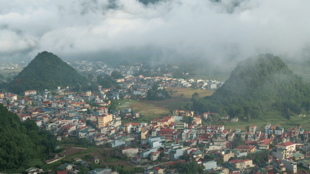
5. Dong Van Old Quarter
Dong Van Old Quarter combines history, culture, and charm. The stone houses, narrow alleys, and traditional markets reflect centuries of ethnic heritage. By night, the streets come alive with food stalls and music — a lively contrast to the peaceful daytime mountain rides.

6. Yen Minh
Surrounded by pine forests and endless terraced rice fields, Yen Minh is a scenic and relaxing stop along the loop. The town’s cool climate and gentle hills make it a favorite overnight destination. It’s also a great place to observe ethnic minorities working in the fields and to enjoy local coffee with mountain views.
What Are the Main Roads of the Ha Giang Loop?
1. Ha Giang City → Quan Ba (46 km)
This first stretch climbs gradually from Ha Giang City into the mountains. As you approach Quan Ba, you’ll pass through small villages and local markets before reaching the iconic Twin Mountains viewpoint, also known as Heaven Gate. It’s the ideal introduction to the Loop’s breathtaking landscapes.
2. Quan Ba → Yen Minh (50 km)
The road from Quan Ba to Yen Minh winds through limestone peaks and wide valleys filled with terraced rice fields. The scenery is lush and peaceful, especially as you enter the cool Yen Minh pine forests. It’s a perfect section for photography and slow riding.
3. Yen Minh → Dong Van (45 km)
This part of the Loop leads you deep into the Dong Van Karst Plateau, a UNESCO Global Geopark. The route is dotted with ethnic minority villages, stone fences, and breathtaking cliffs. It’s one of the most authentic and visually striking sections of the journey.
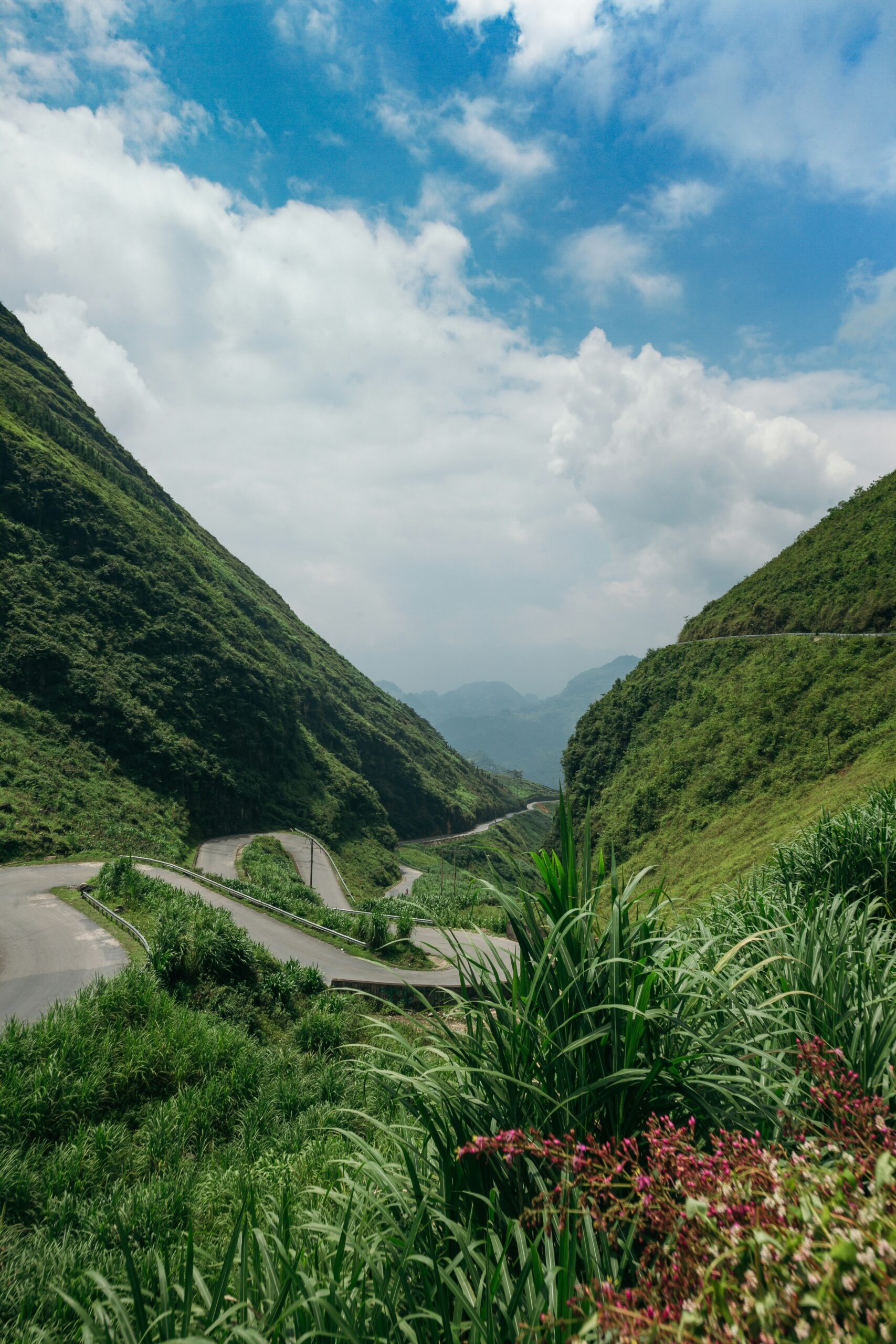
4. Dong Van → Meo Vac (22 km)
Though only 22 kilometers long, this road across the Ma Pi Leng Pass is the highlight of the Ha Giang Loop. The narrow, winding path overlooks the dramatic Nho Que River Canyon, offering views that rank among the most spectacular in Southeast Asia. Every curve reveals another postcard scene.
5. Meo Vac → Ha Giang City (~80 km)
The final leg returns through remote valleys and peaceful traditional hamlets. You’ll ride past quiet farmland, rivers, and forested hills before reaching Ha Giang City again. It’s the perfect way to reflect on your adventure and end the Loop with calm, rural beauty.
Different Ways to Explore the Ha Giang Loop
You can explore the Ha Giang Loop in several ways, depending on your riding experience and how much time you have. Whether you’re looking for a quick adventure or a slow cultural journey, there’s a perfect option for you.
You can explore the Ha Giang Loop in several ways:
🏍️ Easy Rider – A local driver takes care of the road while you sit back and enjoy the views — perfect for beginners.
🛵 Self-Riding – For experienced riders who want full freedom and adventure.
🚙 Jeep Tour – Comfortable and safe, ideal for small groups or travelers who prefer not to ride.
Each option gives a different perspective of the landscapes and culture of Ha Giang.
Depending on how many days you have, you can choose between:
A 2-Day Tour for a fast adventure,
A 3-Day Tour for a balanced experience, or
A 4-Day Tour for a deeper, slower journey through the mountains.
Below, you’ll find each itinerary with its own interactive Ha Giang Loop Map :
2 Days Ha Giang Loop Map
The 2-Day Tour is perfect for travelers with limited time who still want to experience the magic of Ha Giang. You’ll ride through Quan Ba, Dong Van, and the breathtaking Ma Pi Leng Pass, covering the loop’s most iconic highlights. Expect two full days of riding, incredible mountain views, and an unforgettable adventure.
3 Days Ha Giang Loop Map
The 3-Day Tour strikes the right balance between discovery and comfort. It follows the main loop but adds relaxing stops like Du Gia Village and Lung Cu Flag Tower near the Chinese border. You’ll have more time to enjoy local life, visit waterfalls, and take in the stunning scenery without rushing.
4 Days Ha Giang Loop Map
The 4-Day Tour is for those who want to dive deeper into the beauty and culture of Ha Giang Province. With more time to explore, you’ll visit caves, remote villages, and the iconic Ma Pi Leng Pass at a slower pace. It’s the ultimate way to experience both adventure and relaxation on the Ha Giang Loop.
What to Bring for Easier Navigation Around the Ha Giang Loop ?
Navigating the Ha Giang Loop can be tricky — winding roads, limited signal, and similar-looking mountain paths can confuse even experienced riders. To travel safely and enjoy every moment, here’s what you should prepare before hitting the road:
- Download Google Maps or Maps.me (Offline Mode)
Internet connection can be unreliable in the mountains. Make sure to download your maps in advance on Google Maps or Maps.me so you can navigate even without signal. Both apps show key points like gas stations, restaurants, and viewpoints along the loop. - Bring a Power Bank for Long Rides
Between the long distances and constant photo stops, your phone battery will drain quickly. A reliable power bank ensures your GPS stays on all day — especially during remote stretches like Ma Pi Leng Pass or Du Gia Village. - Keep a Paper Map as a Backup
While technology helps, a classic paper map is still the best backup in case your phone dies or loses GPS signal. It also helps you visualize the route and distances between Dong Van, Meo Vac, and Ha Giang City at a glance. - Mark Your Homestays and Stops Before Departure
Before leaving Ha Giang, mark your key stops such as Du Gia, Dong Van, and Meo Vac directly on your map app. It’ll save you time at the end of the day and help you find your way easily — especially when riding at dusk or in the fog.
Do You Really Need a Map to Ride the Ha Giang Loop?
While many parts of the loop are well marked, having a map or GPS is still highly recommended. The terrain is mountainous and remote, and cell service can be limited — especially around Meo Vac and Du Gia.
That said, getting a little lost along the way is part of the magic of the Ha Giang Loop. Some of the best moments come from unexpected turns — discovering a hidden village, meeting locals, or finding a quiet viewpoint you didn’t plan to see. With a good map, you’ll explore confidently while still leaving room for a bit of beautiful adventure between Heaven Gate and the Ma Pi Leng Pass.
Conclusion
The Ha Giang Loop Map is more than just a guide, it’s your key to discovering the wild beauty of northern Vietnam. From the stunning Dong Van Karst Plateau to the peaceful Du Gia village, every kilometer offers a new experience.
Pack your gear, plan your route, and get ready to ride one of the world’s most unforgettable motorbike adventures.
Key Takeaways
- The Ha Giang Loop is Vietnam’s most scenic motorbike route, crossing mountains, rice terraces, and remote ethnic villages in the far north near the Chinese border.
- It can be done in 2, 3, or 4 days, each offering a unique balance between adventure, culture, and relaxation.
- Must-see highlights include Ma Pi Leng Pass, Du Gia Village, Dong Van, Heaven Gate, and Lung Cu Flag Tower.
- You can ride with an Easy Rider, Self-drive, or take a Jeep tour. All providing different perspectives of Ha Giang Province.
- A map or GPS is essential, but getting a little lost often leads to the best discoveries like hidden viewpoints, local smiles, and authentic experiences.